
San Francisco: California is facing its first major storm of the season, bringing heavy rain, powerful winds, mountain snow and dangerous ocean conditions. Winter storm warnings and coastal flood advisories cover large parts of the state.
The latest snow storm weather forecast California update from the San Francisco Chronicle says the cold front moved through the Bay Area Friday, bringing steady rain, thunderstorms and localized flooding.
Rain affected areas stretching from Santa Cruz to Sacramento, while a flood advisory remained in effect for much of the Peninsula, South Bay and East Bay until 3 p.m. Friday.
Forecasters warned that some afternoon and evening showers could become particularly intense. Thunderstorms and lightning were possible, especially across the North Bay, although San Francisco and the Peninsula could also experience heavier rainfall.
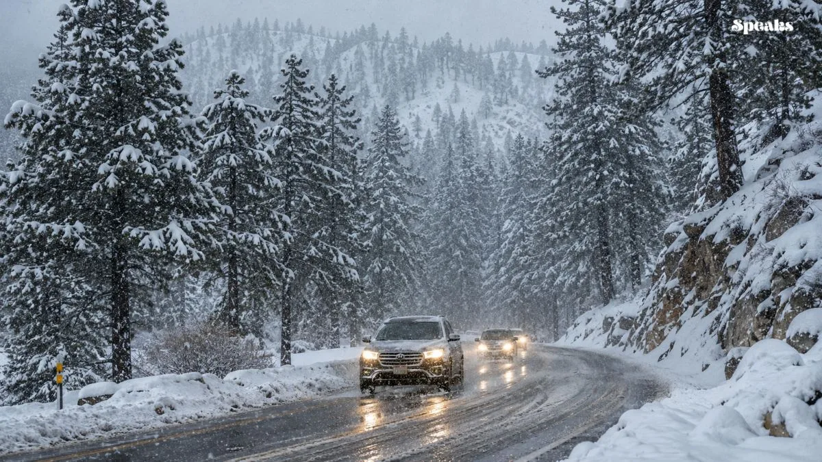
The Sierra Nevada faced more dangerous winter conditions as heavy snow and strong winds moved across mountain passes. Snowfall rates could reach or exceed two inches per hour around Donner Summit.
The highest peaks near Lake Tahoe were forecast to receive between 18 and 20 inches of snow. Areas above 7,000 feet could see approximately a foot, while Truckee and South Lake Tahoe could receive up to six inches.
Snow levels were initially expected to remain between 6,500 and 7,500 feet before dropping toward 5,500 feet. That change could bring accumulating snow to lower mountain communities and highways.
Travel conditions along Interstate 80 over Donner Summit and Highway 50 over Echo Summit were expected to deteriorate during the storm. Strong winds could create near-whiteout conditions and make driving especially hazardous.
Wind gusts of 45 to 55 mph were possible around Donner Summit, while exposed Sierra ridges could experience substantially stronger winds. Drivers were warned to prepare for chain controls, delays and potential road closures.
Coastal conditions were also expected to become dangerous as the storm moved offshore. A high surf warning covered parts of the California coastline, with waves reaching 25 to 35 feet at many beaches.
At exposed locations such as Mavericks near Half Moon Bay, waves could reach approximately 50 feet. Officials warned that powerful surf could send water over seawalls and onto nearby coastal infrastructure.
Flooding was reported along San Francisco’s Embarcadero, where standing water covered sections of the bike lane near Pier 14. Extremely high tides were obstructing storm drains and preventing rainwater from draining normally.
The weather disruption also affected San Francisco International Airport. The FAA imposed a ground stop for inbound short-haul flights from the West Coast until 12:15 p.m. Friday, while departing flights experienced significant delays.
The snow storm weather forecast California outlook also included another weather system expected to arrive Sunday. That system could bring additional rain and mountain snow to Northern California, although its expected strength remained less certain.