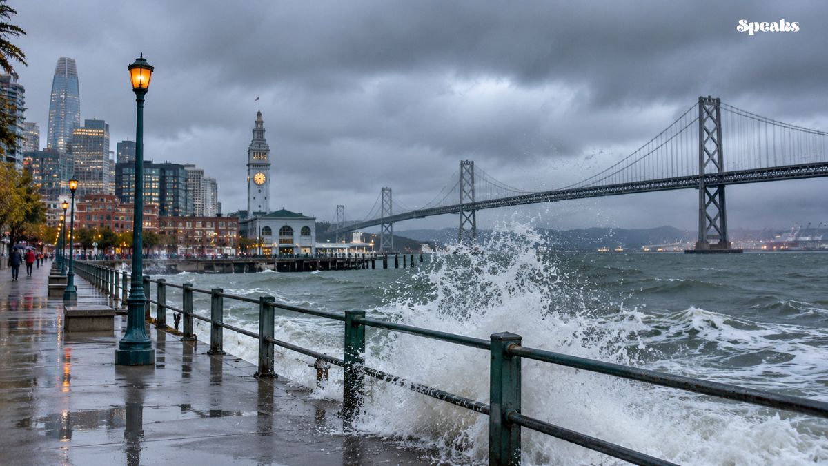
A coastal flood warning is set to take effect across parts of the San Francisco Bay Area as unusually high tides raise the risk of flooding along vulnerable shorelines. The National Weather Service says water levels could reach up to 3 feet above ground in some low-lying locations.
The warning covers the San Francisco and San Pablo Bay shorelines and is scheduled to run from 6 a.m. Monday, November 23, through 4 p.m. Thursday, November 26, according to the National Weather Service.
The alert comes as California approaches a period of exceptionally high seasonal tides, commonly known as King Tides. Officials are urging residents, commuters and coastal businesses to prepare for possible flooding, road closures and shoreline erosion.
Coastal Flood Warning: Areas Under the Alert
The National Weather Service issued the warning for San Francisco, North Bay Interior Valleys and the San Francisco Bay shoreline forecast zones. The expected flooding threat is concentrated along the San Francisco and San Pablo Bay shorelines.
Low-lying areas near shorelines and tidal waterways face the greatest risk. Flooding could affect roads, waterfront infrastructure, parking areas and other locations close to the water.
The agency has also kept a coastal flood advisory in place through 6 a.m. Monday. That advisory allows for up to 2.1 feet of inundation above ground in vulnerable locations before the stronger warning period begins.
King Tides Could Push Water Levels Higher
The approaching King Tides are a major factor behind the latest alert. These exceptionally high astronomical tides occur when the gravitational effects of the moon and sun combine to produce higher-than-usual water levels.
At the San Francisco tide gauge, the National Weather Service forecast high tides rising progressively through the middle of next week.
The predicted levels are:
- Saturday, November 21: 1.5 feet above normal at 8:15 a.m.
- Sunday, November 22: 2.1 feet above normal at 8:48 a.m.
- Monday, November 23: 2.3 feet above normal at 9:25 a.m.
- Tuesday, November 24: 2.9 feet above normal at 10:05 a.m.
- Wednesday, November 25: 3 feet above normal at 10:49 a.m.
- Thursday, November 26: 2.6 feet above normal at 11:38 a.m.
The Wednesday forecast represents the highest predicted tide in this period at the San Francisco gauge. Actual conditions can vary by location, and high tide may occur up to 90 minutes earlier or later along the Pacific Coast and within the bay.
Flooding Could Affect Roads and Waterfront Infrastructure
The National Weather Service warns that high tides could cause significant flooding in low-lying areas near the bay. Potential impacts include flooded infrastructure, multiple road closures and coastal erosion.
As water levels rise, waves may travel farther up beaches than usual. This can reduce the available space for people to move away from the water and create dangerous conditions along exposed shorelines.
Residents in flood-prone neighborhoods should pay attention to local alerts and avoid parking vehicles in areas that regularly experience tidal flooding.
Drivers should also be prepared for detours if roads near the shoreline become impassable. The National Weather Service advises people not to drive around barricades or attempt to cross water of unknown depth.
Other California Coastal Areas Face Separate Flood Alerts
The San Francisco Bay warning is not the only coastal alert affecting California. The National Weather Service has issued separate advisories and watches for other parts of the state as high tides and large surf approach.
Along the North Coast, a coastal flood watch is in effect for Coastal Del Norte, Southwestern Humboldt and Coastal Mendocino counties from Tuesday morning through Thursday afternoon.
Forecasters say high astronomical tides and large surf could cause moderate to major flooding in vulnerable areas along the Redwood and Mendocino coasts. Between one-half foot and one foot of saltwater inundation above ground is possible in some low-lying locations.
Northern Coastal Humboldt also has a separate advisory for minor flooding around Humboldt Bay, followed by a coastal flood watch extending from Sunday morning through Thursday afternoon.
Further south, coastal flood advisories and watches cover additional areas, including parts of the Central Coast and Southern California. Residents should check the alert issued for their specific county rather than assuming that all coastal areas face the same level of risk.
What Residents Should Do Before the High Tides
People living or working near the shoreline should take precautions before the highest tides arrive. Moving vehicles away from flood-prone streets and securing outdoor belongings can help reduce potential damage.
Residents should monitor updates from the National Weather Service and local emergency officials. Tide conditions can change, particularly if strong winds, large surf or additional storm activity coincide with high tide.
Anyone visiting beaches, piers, seawalls or rocky coastal areas should remain alert. Waves can reach farther inland than expected, and flooded access routes may make it difficult to leave safely.
The National Weather Service also recommends avoiding flooded roads and following official closures. Even shallow-looking water can conceal hazards or make driving conditions unsafe.
Weather Alerts to Watch Through November 26
The current forecast points to the highest predicted tides around November 24 and 25, with elevated levels continuing into Thanksgiving Day.
The coastal flood warning for the San Francisco and San Pablo Bay shorelines is scheduled to remain in effect until Thursday afternoon. Separate watches and advisories may also be updated as forecasters assess changing tide, surf and weather conditions.
Residents should continue checking official forecasts for their area, especially before traveling near bays, beaches and other low-lying coastal locations.